Mount Fuji is Japan's most famous landmark which can always be seen in photographs and postcards. But seeing it for real is another matter. June is the raining season in Japan, so I was kind of worried whether we really get to go to Mount Fuji. Because if it rained, we would have just gone to Ueno instead. But, thanks to this little buddy the day was rather fine enough for hiking, although there were clouds.
 This guy is not a voodoo doll, mind you. He's a teru teru bōu zu (てるてる坊主), which we made during Multicultural Communication class a few weeks earlier to wish for fine weather.
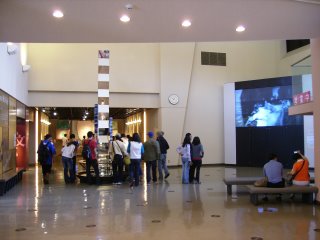
We left at 8.30am sharp and reached Mount Fuji's Visitor Center some two hours later.

Trivia: Foreigners were not allowed to climb Mount Fuji because it was considered sacred by the locals.

Trivia: Japan once applied for Mount Fuji to be included as a world heritage site but was rejected because of the startling amount of trash left behind by hikers on the mountain.

Mt. Fuji has five lakes around it: Lake Kawaguchi, Lake Yamanaka, Lake Sai, Lake Motosu and Lake Shoji. They, and nearby Lake Ashi, provide excellent views of the mountain. It is part of the Fuji-Hakone-Izu National Park.

Trivia: Women were prohibited from climbing Mount Fuji during olden days. The first woman who accomplished the feat was
Tatsu Takayama who disguised herself as a guy in order to achieve the feat.

Stone samples taken from Mount Fuji.

There are various access points to the summit of Mount Fuji and we took the Fuji Subaru Line.

We haven't started climbing yet but we're already 2305m above sea level, which is the fifth station.

Meet
Bowo from Indonesia, who rejoice in the nickname 危ない人 (
dangerous guy), courtesy of 金子先生 (
Kaneko Sensei).

It wasn't cold (15ºC) or so but there was snow (残雪,
zan setsu)! The guy in front is
Tunchis from Peru, a.k.a.
Arturo, a.k.a.
Camas. The reason he goes by so many names is merely to confuse the others.

Romantic, huh? Good enough for me considering that this is my first time seeing snow, even though it wasn't exactly snow white.

The higher we went, the barren the landscape.

Uh oh. We were busy taking photos and were left behind by the others...

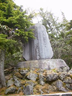
God Almighty Fujisan, please accept these modest offerings from thy humble subjects and do point us to the right path!

An abandoned shack.

Finally, here's everyone! Too bad this was as far as we would go for this hiking trip. Here's where we had lunch eating
bentō (弁当, that's very
Japanese, for your information).

Hmm, Mount Fuji looks better from afar. Especially from its five lakes (富士山五湖). It is said that only good persons can see Mount Fuji. The peak can only be half-seen in this photo. I'm a good guy,
no doubt. It's just my camera which isn't good enough.
The hiking track is accessible only from July to August, when the temperature is the highest all year round, 5ºC. I'll be back, then, with a new camera to take photos from the lakes and to make it to the summit at 3776m above sea level, of course.

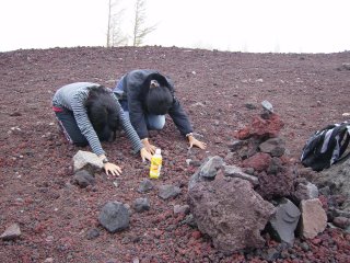
But, I think the summit is as barren as it is on moon, just like this. With all those loose volcanic stones, it was difficult to climb up the slope, although it wasn't that steep. But, after the cliff-hanging stunt we used to do back on Penang Hill, what's the big deal?

Class photo taken by TST. Then, we took group photos of everyone from the center and started the descend.

Ah,
Engrish.

Another perfect animal-looking tree stump ideal for pagan worshippers?

Pine cones.

The fifth station (2305m above sea level), where I bought enough postcards to open a gallery.

Just fooling around...

After everyone got satisfied emptying his wallet, we headed for Narusawa Volcanic Icicle Cave (鳴沢氷穴), which was literally cooler than Gua Tempurung in Perak, Malaysia...
- 02 June 2006, Friday -
 The entrance to the icicle cave.
 The descend.
 A mini shrine.
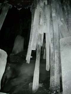
 It's hard to imagine how the ice could form though it's summer now and the place was situated at the foot of Mount Fuji.
 Now, this was cool!
 Natural icicles hanging from the cave.


